Saturday Snapshots: Wych Elm

We have a wych elm in the back garden. This year it’s been absolutely full of seeds, many more than usual:

Wych elm P1080810

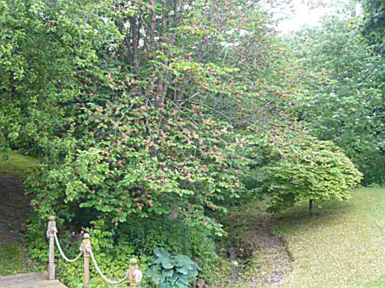
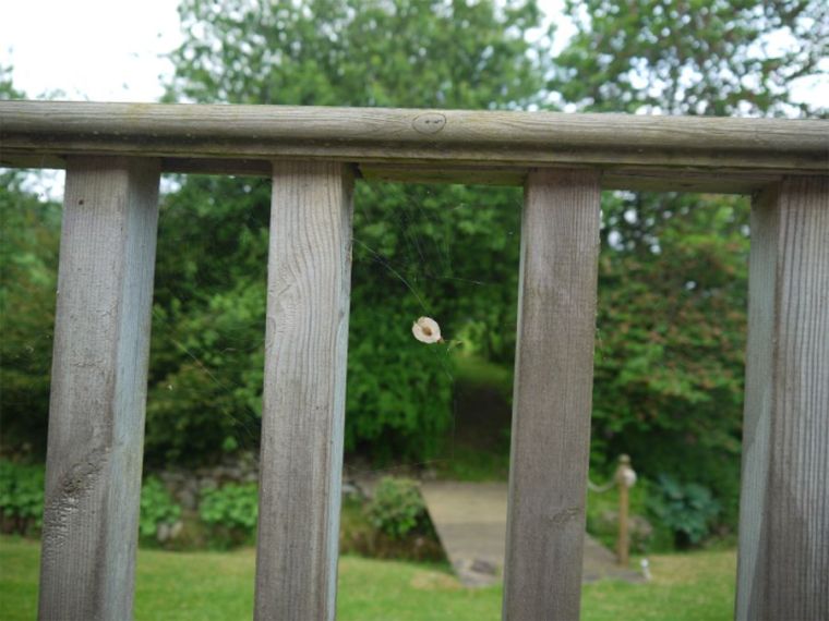
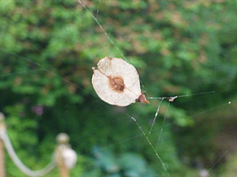
The seeds have been blowing all over the garden, covering the lawn and borders. They grow in clusters:Wych elm P1080813
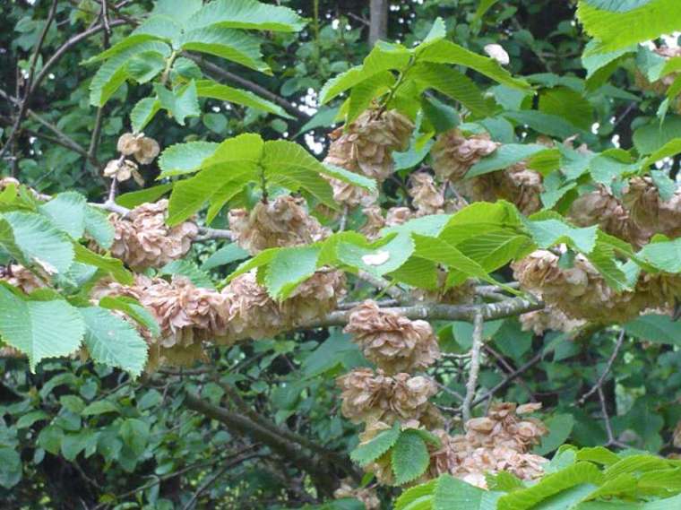
One got caught in a cobweb:

Wych elm seed P1010780Here it is in close-up:

Wych elm seed P1080809Wych Elms are hardy trees and have greater resistance to Dutch elm disease than other elms. The name ‘wych’ comes from an Anglo-Saxon word meaning pliable and refers to the tree’s twigs. Its wood has many uses, including underground water pipes (in the past), boat building and the seats of chairs – it’s also the traditional wood used for coffins.

I love trees – and they are good for you:

A garden without trees is as hard to envisage as an art gallery with pictures. Trees soften the landscape. They provide shade in the summer and protection during the winter. A screen of trees around the house can provide enough wind-shelter to reduce by a tenth the energy consumption in the home. Their canopy of leaves acts as a highly effective pollution filter, absorbing many of the major atmospheric pollution gases, including carbon monoxide, nitrogen and sulphur dioxide. Research also reveals that we are happier and more relaxed when we are in leafy surroundings … (The Therapeutic Garden by Donald Norfolk page 105)

For more Saturday Snapshots see Melinda’s blog West Metro Mommy Reads.

Click on the photos to enlarge.

Saturday Snapshots: Loch Ness

My Saturday Snapshots are some more photos from our last holiday in Scotland. We had been to Inverness and decided to drive back to Coylumbridge along the road following the western shore of Loch Ness. We stopped and went down these steps from the road.Loch Ness steps P1080650It was a calm peaceful scene – no sign of anything on the loch – not a monster in sight.Loch Ness P1080647There are a few interpretation boards by the side of the road above Loch Ness. They are not in very good condition now, a bit dirty, but you can still read them. The one below states that St Columba is said to have seen the monster in the 6th century, that ospreys fish in the loch and that seals sometimes visit chasing salmon and trout. What I didn’t know is that a Wellington bomber had crashed in the loch during a snowstorm in 1940.

Loch Ness Interpr Board P1080651

The next board states that the loch is 38km long and up to 238m deep, rivers feeding into the loch generate hydro-electricity that was first used industrially in 1895 for smelting  aluminium. This board includes information about the Caledonian Canal, which links Inverness in the north to Fort William about 60 miles to the south. The canal, constructed by Thomas Telford and completed in 1822, is really a system of four canals linking to the lochs, one of which is Loch Ness.Loch Ness Interpr Bd P1080653I think it’s time for some new interpretation boards to replace these old and grubby ones!

For more Saturday Snapshots see Melinda’s blog West Metro Mommy Reads

Saturday Snapshots

This Saturday I’m continuing to post photos from our recent holiday in Scotland.

This is Loch Morlich  is in the Glenmore Forest Park, 300 metres above sea level, between Aviemore and Cairngorm Mountain.

Loch Morlich P1080591

Loch Morlich P1080595

There is a level circular walk around the Loch, which has a Sailing Club. I took the two photos shown above on a wet and cloudy afternoon when there weren’t many people around. I hadn’t expected to find a beach so close to the mountains and about 30 miles from the sea!

Later in the week on a brighter day we went back to Loch Morlich, just a bit further round the shore. This part of the Loch is the home of Loch Morlich Watersports Centre and we arrived just as groups of young people were leaving, so we had the beach to ourselves: :

Loch Morlich P1010773 There is a Beach Cafe:

Loch Morlich watersports 01

Loch Morlich Boathouse Cafe

Loch Morlich is managed by Forestry Commission Scotland and is the first and only fresh water loch to ever have received the Rural Beach Award in Keep Scotland Beautiful’s (KSB) Seaside Award campaign.Loch Morlich watersports 02

Click on the photos to enlarge.

For more Saturday Snapshots see Melinda’s blog West Metro Mommy.

Saturday Snapshot

We’ve been away last week – we went here:

Caringorms P1080750
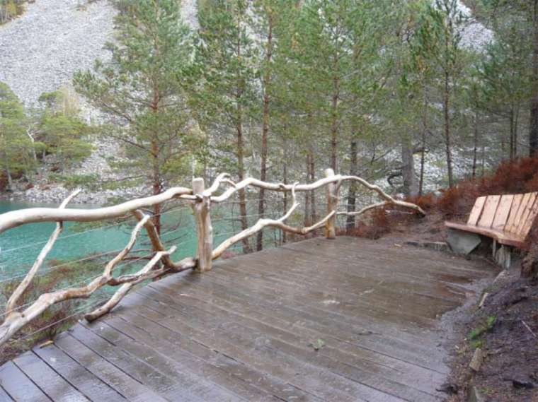
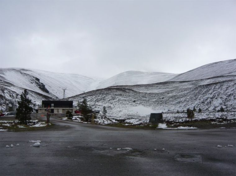
the Cairngorms – and there was snow in May.

Cairngorm shop P1080752
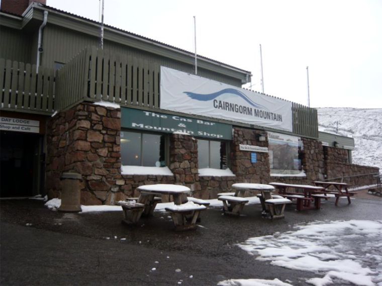
Lower down the snow fell too but didn’t stick. The photo below is of a beautiful little loch in the Glenmore Forest Park, An Lochan Uaine the ‘green lochan’ (although in my photo it looks blue – it was really green!). ‘Lochan’ is Gaelic for ‘ a small loch, or lake’.

An Lochan Uaine P1080677
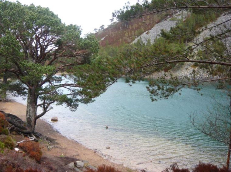
The green shows up more in this photo:

An Lochan Uaine P1080681

We have many more photos, which no doubt, I’ll be posting and writing about later. Click on the photos to see them enlarged.

For more Saturday Snapshots see Melinda’s blog West Metro Mommy.

Berwick's Elizabethan Ramparts

Following on from last Saturday’s Saturday Snapshots here are a few more photos of Berwick-upon-Tweed, which is the northernmost town in England. It’s a Border town that changed hands between England and Scotland 14 times until it finally became part of England in 1482. It’s a walled town; the original medieval walls were built in the 13th century and the Elizabethan Ramparts, dating from 1558 are virtually intact.

Berwick Elizabethan Ramparts

The fortifications replaced the medieval wall on the North and East sides of the town. The photo above shows part of the Elizabethan wall that is now the boundary wall of a car park.

Below are two photos of sections of the walls:

Berwick Ramparts 1

Berwick walls & bridges

The photo below shows a Russian cannon, captured in the Crimea. Before the Second World War this part of part of the walls was once bristling with artillery. All that remains now is this cannon which was brought back as one of the trophies at the end of the Crimean War (1854-56). The top of the barrel of the gun is embossed with the double-headed eagle emblem of the Russian Tzar.

Berwick Ramparts Canon

For more Saturday Snapshots see Alyce’s blog At Home With Books.

Saturday Snapshot: Berwick Castle

There is little left of Berwick Castle. Ruins are almost as enticing as libraries and bookshops to me. If there are any of these in an area I love to go and explore, so it’s amazing that after living near Berwick-upon-Tweed for over three years the most I’ve seen of Berwick Castle is the view of a wall from Berwick Railway Station. It was the building of the railway that caused the Castle’s final destruction when in 1847 substantial parts of the Castle were demolished to make way for the Station! Apparently the walls were so thick they had to use gunpowder to reduce them to rubble.

We were in Berwick on Wednesday; it was a dismal afternoon as rain blew in from the North Sea, not ideal for taking photos, especially on a camera phone. I’ll go back another day, when the sun is out, to take more photos.

The photo below shows the approach to the Castle ruins from Coronation Park above the River Tweed. The Park was created to celebrate the coronation of George VI in 1937. The area at the top of the Park was known as Gallows Knowe. It was the place of public executions in Berwick, the last being in 1823 – maybe the very place where we stood to take photos.

Berwick Castle grounds IMG_0459

The Castle was first recorded in 1160, probably built by King David I of Scotland, and was completely rebuilt by Edward I of England, after he captured it in 1296, with a strong circuit of walls,  towers and turrets, including royal apartments, a great hall and a chapel. Berwick- upon-Tweed is the most northerly town in England. a border town that changed hands between England and Scotland many times until 1482 when it was retaken from Scotland.

The photo below shows the castle mound, and the remains of the castle walls, including a rounded gun tower . On the right of the photo the White Walls are visible – this was a battlemented wall that still runs from the corner of the castle down to the River Tweed. It was built to defend the river approach to the castle and town around 1297 – 1298. Also, just about visible on the extreme right of the photo is the Royal Border Bridge carrying the railway line into Berwick Station.

Berwick Castle mound and wall IMG_0469The next photo (below) shows more detail of the Bridge and White Walls.

Berwick Castle and Royal Border Bridge IMG_0475For more Saturday Snapshots see Alyce’s blog At Home With Books.