Dunstanburgh Castle

Dunstanburgh Castle P1020073

I think that Northumberland is one of the loveliest parts of the United Kingdom, with the Cheviot Hills and in particular the beautiful golden sands along the coast of the North Sea. It also has a large share of castles. Since we moved here we’ve visited all of the coastal castles, except that is the ruins of the castle at Dunstanburgh. It’s a spectacular ruin standing alone on the coast on an isolated headland between Embleton and Craster, looking out over the North Sea.

Last Tuesday we decided it was time for us to go there. It was a lovely hot, sunny day and we walked from the car park down the road to the little village and harbour at Craster, well known for its kippers.

Craster P1020067

From there it’s about a mile and a half walk northwards along the coast to the castle, which is owned by the National Trust (NH) and managed by English Heritage(EH). But we never actually got to the castle, because the heat defeated us and my knee, which has been a problem for a few months now, became painful so we only walked about halfway there, then turned back. I took a few photos zooming in as close as I could:

Dunstanburgh Castle P1020072

Thomas, Earl of Lancaster began building Dunstanburgh Castle in 1313. He was the wealthiest nobleman in England at the time and later took part in the barons’ rebellion against Edward II, resulting in his execution in 1322. John of Gaunt modernised it in the 1380s and later during the Wars of the Roses it became a Lancastrian stronghold, finally falling into ruin in the 16th century.

We will go there again to see more. At least we enjoyed the coastal walk and the view of the castle, despite the heat. And as always I was trying to visualise what it must have been like when it was new and how it had changed over the centuries, thinking of the battles that it had seen, of all the people who had lived and died there.

The Bronte Parsonage Museum, Haworth

We visited the Bronte Parsonage Museum in Haworth a few weeks ago.

Bronte Museum sign P1010267
Bronte Museum sign


Bronte Parsonage Museum P1010266

BPM front P1010269

You can’t take photos inside the museum, so I bought the guide book and a booklet, The Brontes and Haworth to remind me of our visit and you can see some photos on the Bronte Society website. It’s a fascinating house – a recreation of the Brontes’ home, as well as a museum displaying memorabilia, manuscripts, books and artworks. There is so much to see and all in a smaller house (with small rooms) than I had imagined.

I knew that the Brontes wrote their stories and poems in tiny notebooks (about the size of a credit card) in small handwriting but seeing the original manuscripts I was amazed at just how very small it is! And standing next to the display cabinet containing Charlotte Bronte’s dress she wore to set out for her honeymoon tour in Ireland I could see she wasn’t very tall – certainly less than 5ft.

The museum contains some of the Brontes’ paintings and drawings and Emily’s mahogany artist’s box – they really were talented in more than one field. I was intrigued by a large cupboard with 12 panels on the door, each panel containing a painting of one of the 12 apostles. I was even more fascinated by it and wished I’d been able to take a photograph of the cupboard, when later on whilst re-reading  Jane Eyre I came across this description of a cabinet in a room on the third storey of Thornfield Hall:

the doors of a great cabinet opposite – whose front, divided into twelve panels, bore in grim design, the heads of the twelve apostles, each enclosed in its separate panel as in a frame …

According as the shifting obscurity and flickering gleam hovered here or glanced there, it was no the bearded physician, Luke, that bent his brow; now St John’s long hair that waved; and anon the devilish face of Judas, that grew out of the panel, and seemed gathering life and threatening a revelation of the arch-traitor – of Satan himself – in his subordinates form.

I realised that this was the cupboard I had seen in the Museum! I’d stood in front of it for some while wondering what it was as there is nothing in the guide book about it.  Seeing it at night by candlelight must have been very different from standing in a museum looking at it in daylight! Since then I’ve been unable to find out much about this cupboard, apart from a post on the Stubbs Family History blog, which explains how the Museum acquired the cupboard. And you can see a photograph of it here.

I now intend to read more of Charlotte Bronte’s novels and Mrs Gaskell’s biography of her friend, The Life of Charlotte Bronte, first published in 1857 – Charlotte had died in 1855, aged 38.

I’d also like to read a more modern biography, maybe Charlotte Bronte: a Passionate Life by Lyndall Gordon or The Brontes by Juliet Barker about the family.

What would you recommend?

The Lake District – Honister Pass

Honister Pass P1010084
Honister Pass

Whilst we were staying in the Lake District a few weeks ago we drove through the Honister Pass, one of the highest passes in Cumbria. It connects the Buttermere Valley with the eastern end of Borrowdale Valley. There is a slate mine but we didn’t have time to take a tour – just enough time for a quick drink and a look round the cafe/shop/showroom and stone garden.

Honister Slate mine P1010070
Honister Slate Mine entrance
Honister Sky High Cafe P1010069
Honister Sky High Cafe

The little stone garden is most unusual:

Honister - stone garden
Honister – stone garden
Honister - stone garden
Honister – stone garden

and they fly the flag in the cafe:

Honister Sky High Cafe

as well as in words on this slate at the entrance:

Fly the Flag
Fly the Flag

For more Saturday Snapshots see Melinda’s blog West Metro Mommy Reads.

The Lake District: Aira Force

Last Saturday I wrote about our trip on Ullswater on a grey, overcast morning, a couple of weeks ago. That same day the the sky cleared, and the sun shone as we went to see Aira Force, below Gowbarrow Fell above the shores of Ullswater.  You wouldn’t have thought it was the same day, as the extra layers of clothing had to come off!

Aira Force (from ‘fors’ the Viking word for waterfall) is a beautiful, wonderful place – a series of waterfalls, cascading down a fracture in the ancient volcanic rocks in a deep gorge. People have been visiting Aira Force for about 250 years. This is the plan of Aira Force on the National Trust board at the entrance to the Glade (with my added notation):

Aira Force plan P1010130

 From the Glade you start to ascend the waterfall walking through the Pinetum, which includes firs, pines, spruces, cedars and yews planted in the 19th century. The photo below shows the trunk of a Monkey Puzzle tree, the top way above me:

Pinetum P1010133The paths are circular, most of them dating back to the early 19th century when visitors were escorted by tour guides. There are three bridges across the Aira Beck – the first reference to a bridge was by Wordsworth in 1787. Below is a view of one of the bridges:

Bridge P1010140There are also several sets of steps:

Steps P1010144and of course, the cascades, falling 66 feet from the top to the bottom:

Waterfall P1010149I managed to snap a rainbow:

Rainbow P1010148

For more Saturday Snapshots see Melinda’s blog West Metro Mommy Reads.

The Lake District: Ullswater

The shore of Ullswater is famous as the place that inspired Wordsworth to write his poem ‘I wandered lonely as a cloud‘, after a lakeshore walk in 1802, and it’s also where Donald Campbell broke the world water speed record on 23 July 1955 in the jet powered Bluebird K7. The lake is a ribbon lake formed after the last ice age, sculpted by three separate glaciers.

There were no speed boats on the lake, they’re banned now, and the season for daffodils was over on the dull, cloudy morning when we went on a ‘steamer’ on Ullswater, during our recent holiday in the Lake District. The Ullswater ‘Steamers’ have been sailing on the lake since 1859 and the oldest boat currently still in use is the Lady of the Lake, built in 1877, believed to be the oldest working passenger vessel in the world. It was in steam until the 1930s and it was the boat we boarded for our trip down the length of the lake and back again.

Waiting for the boat at Glenridding Pier
Lady of the Lake P1010111
On board the Lady of the Lake

Even though the weather wasn’t very good it wasn’t raining and we had a pleasant trip with views of both sides of the lake and the mountains .

Norfolk Island, Ullswater P1010103
Norfolk Island, Ullswater
Pooley Bridge pier P1010112
Pooley Bridge Pier
return journey P1010120
Ullswater

For more Saturday Snapshots see Melinda’s blog West Metro Mommy Reads.

Castlerigg Stone Circle

Stone circles are amongst the most tangible and durable connections to the past. They have fascinated me ever since I was a young teenager and saw Stonehenge. We were on our way to Girl Guide camp in the New Forest, travelling overnight by coach from Cheshire and reached Stonehenge just before dawn. I was just about awake as we scrambled down from the coach and made our way over the field to be at Stonehenge as the sun came up. It was magical.

We were the only people there and in those days Stonehenge was fully accessible. I’ve been there since, and seen it on TV but I am so glad I had that experience before full access to Stonehenge was available, before there was a carpark and a visitor centre, shop and cafe. Now you can only view the stones from a short distance away along a tarmac pathway – after you’ve planned your visit in advance, parked your car and been driven 10 minutes by a shuttle bus, because entry to Stonehenge is by timed tickets. (Access is free at the solstices.)  I understand the need for all this but it still makes me shudder.

When I discovered that there is a stone circle near Keswick I was keen to go there whilst we were staying in the Lake District last week. Although there were more people at Castlerigg Stone Circle than I would have liked I really did appreciate the informality of the site.  There are no restrictions and you can wander around the stones as much you like. I suppose you’d have to get there at dawn or at least a lot earlier than we did to be there on your own.

Castlerigg is set on a plateau near Keswick, surrounded by hills, including Skiddaw and Blencathra. There is no carpark, visitor centre or shop – and I hope it stays that way. You can park in a little lane, where there was an ice-cream van selling delicious home-made ice-cream on the day we were there.

This was our first sight of the stones:

Approaching Castlerigg Stone Circle (1)  P1010056

Stone circles are ancient monuments. There are over 50 stone circles in the Lake District, made with locally available stones. Nobody knows what their function was, although there is much debate about whether they had a ritual and religious use, an astronomical significance or an economic function.

Castlerigg dates from around 5,200 BC which makes it older than the pyramids! Here is part of the circle. It is about 30 metres in diameter, which makes it quite difficult to take photos of the whole circle:

Castlerigg view 2

As you can see that the stones vary in size. The tallest stone is 2.3 metres and the largest weighs about 16 tonnes.

Castlerigg P1010061

And here are two photos of parts of the interpretation boards:

Int Bd Castlerigg P1010051

Int Bd Castlerigg P1010052

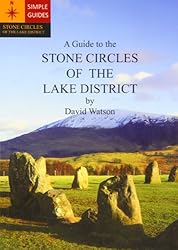
Castlerigg Stone Circle is described A Guide to the Stone Circles of the Lake District by David Watson, published in 2009 with colour photographs, maps and directions to the sites. The cover photo shows Castlerigg Stone Circle.

For more Saturday Snapshots see Melinda’s blog West Metro Mommy Reads.

Still Catching Up

I’ve been missing from my blog for most of September, but I’ve still been reading. We’ve just returned from a  few days in the Lake District – such a beautiful part of the UK!

Caldbeck P1010042
Caldbeck Cumbria

I managed to squeeze in some reading time as well as walking in the fells near Caldbeck and visiting the Pencil Museum in Keswick, Castlerigg Stone Circle, the Honister Pass, Ullswater and Aira Force. I’ll post some photos later on.

I took two books with me that I had already begun reading and finished one of them – Entry Island by Peter May. I’ve previously read May’s Lewis Trilogy – The Blackhouse, The Lewis Man and The Chessmen all of which I loved and whilst I did enjoy Entry Island I don’t think it quite lives up to the Lewis books. However, as I discovered when I came home this weekend Entry Island has been awarded the third annual Deanston Scottish Crime Book of the Year Award at the Bloody Scotland Crime Writing Festival.

Entry Island is set in present day Magdalen Islands, part of the province of Quebec, in the Gulf of St Lawrence, and in the nineteenth century on the Isle of Lewis at the time of the Highland Clearances.  It mixes together two stories and two genres, crime fiction and historical fiction. It has a strong sense of place in both locations and beautiful descriptions of the landscape as for example in this passage:

It was another ten minutes before the ferry slipped out of the harbour, gliding past the outer breakwater on a sea like glass, to reveal Entry Island in the far distance, stretched out on the far side of the bay, the sun only now rising above a gathering of dark morning cloud beyond it. The island drew Sime’s focus and held it there, almost trancelike, as the sun sent its reflection careening towards him, creating what was almost a halo effect around the island itself. There was something magical about it. Almost mystical. (page 14)

The characters are convincing – Detective Sime Mackenzie, based in Montreal is part of the team sent to Entry Island to investigate the death of the wealthy businessman, James Cowell found stabbed to death. His wife, Kirsty is the obvious suspect. Sime is suffering from insomnia, a situation made worse by the fact that his ex-wife is also on the investigating team. Sime is convinced that he knows Kirsty, although they have never met before and he doubts that she is the culprit. Running parallel to this crime fiction element is the historical one, linked by Sime’s ancestor, also called Sime who was a crofter’s son on the Isle of Lewis and whose love for the laird’s daughter seemed doomed from the start. The story of life on Lewis and the harsh treatment the crofters received during the potato famine, followed by the terrible conditions they endured during their transportation to Canada is powerfully and emotionally portrayed.

The two stories are linked together well, but I found the present day investigation not too convincing and rather contrived as the team seemed to jump to conclusions without much thought or thorough investigation of the evidence. And I thought that the historical element was dominant at the expense of the modern day crime story making the book a little unbalanced. However, as I said I liked the book, which is an entertaining read that held my interest to the end.

Peter May is a prolific author. He was born and brought up in Scotland, but he now lives in France. As well as The Lewis Trilogy he has also written The Enzo Files, a series of seven books featuring Scottish forensic scientist, Enzo MacLeod, who lives in France, teaches at a university in Toulouse, and is working on solving seven of France’s most famous cold cases by applying the latest scientific techniques and The China Thrillers, a series of six books featuring Beijing detective Li Yan and Margaret Campbell, forensic pathologist from Chicago. He has also had a successful career as a television writer, creator, and producer. 

I still have three other books to write about, including my first book for this year’s R.I.P. Challenge, Testament of a Witch, which like Entry Island also qualifies for the Read Scotland 2014 Challenge. Will I ever catch up with myself?

Cragside: The Turkish Baths

I haven’t done a Saturday Snapshot for months!

Turkish Bath P1090264

Here are some photos of the Turkish Baths at Cragside, in Northumberland that I’ve been meaning to post since our last visit. There’s a lot to see at Cragside. It’s now owned by the National Trust and was formerly the home of William George Armstrong (1810 – 1900). We didn’t manage to see this suite of rooms the first time we visited as there was quite a queue.  But on our second visit there weren’t as many people. You go down stairs from the Library lobby to go into the rooms below the Library. The guide book describes them as:

The suite of rooms includes a steam bath, a cold plunge, a hot bath and a shower, as well as water closets and a changing room. They are the lowest and the first completed part of Norman Shaw’s first addition to the original house. His plan, which shows that modifications were still being made, is dated 5 May 1870, and Armstrong’s friend, Thomas Sopwith, recorded in his diary that €˜the Turkish Bath at Cragside was used for the first time on November 4th 1870€².
The baths were part of Lord Armstrong’s innovative provision of central heating for the whole house. The space occupied by the baths is cleverly situated between chambers with huge water-pipe coils, which, heated from the boiler to the north, were the source of hot air that was ducted up into the main house. (NT guide book for Cragside)

Turkish Bath P1090265

Turkish Bath P1090266Apparently, Lord Armstrong was keen to build up foreign business and thought that:

Chinese or Burmese, or Japanese arms ministers would be more likely to agree to handsome contracts, if they were both well entertained and comfortable – even in a Northumbrian winter. (NT guide book for Cragside)

I think it’s an excellent idea and wish we had space for something similar!

The Steel Bonnets by George MacDonald Fraser

The Steel Bonnets 001The full title of this book is The Steel Bonnets: the Story of the Anglo-Scottish Border Reivers by George MacDonald Fraser. It’s a detailed account of the Border between England and Scotland up to the accession of James VI’s succession to the English throne in 1603.

The people living in the Borders, both English and Scottish feuded amongst themselves, Scots against Scots, English against English, and Scots against English – robbery, blackmail, raiding, arson, kidnapping, murder and extortion were regular events during that period, amongst a number of families, including Armstrongs, Johnstones, Forsters and Hetheringtons, Elliots, Fenwicks, Bells and Nixons, Littles and Scotts, Maxwells and Kerrs. Some families had both English and Scottish members, making it all very confusing. Fraser searched many sources in compiling this history, including State and Border papers and letters, listed in the Bibliography.

There is a map showing the six Marches that made up the Border – three on each side, East, Middle and West. Each March had its own Warden. It’s not very easy to see on my copy of this map, but it shows the general locations:

Border Marches map

The seamen of the first Elizabeth might sweep the world’s greatest fleet off the seas, but for all the protection she could give to her Northumbrian peasants they might as well have been in Africa. While young Shakespeare wrote his plays, and the monarchs of England and Scotland ruled the comparatively secure hearts of their kingdoms, the narrow hill land between was dominated by the lance and the sword. The tribal leaders from their towers, the broken men and outlaws of the mosses, the ordinary peasants of the valleys, in their own phrase, “Shook loose the Border.” They continued to shake it as long as it was a political reality, practising systematic robbery and destruction on each other. History has christened them the Border Reivers.*

*Reiver, reaver – robber, raider, marauder, plunderer. the term is obsolete, but lingers on in words like bereave. (page 3)

The book is divided into five parts:

  • Part I a brief historical sketch up to 1500 from the Roman period.
  • Part II describing what the Border was like in that century, the people who lived there, who were the leading robber families, how they lived, ate, dressed, built their homes, the games they played (football, the fore-runner of rugby, soccer and American football, horse racing, hawking, hunting, fishing and gambling), and the songs they sang – Border ballads.
  • Part III – about the reivers, how they rode their raids, conducted their feuds etc and the Border Law, and how the March Wardens tried to keep order, what it was like for ordinary folk living in the frontier country.
  • Part IV – historical survey of the reiving century from 1503 – 1603, how the reivers fitted into the history of their time and the part they played in the long-drawn Anglo- Scottish struggle..
  • Part V – how their story ended when England and Scotland came under one king, and the old Border ceased to be.

James became the King of all Britain in 1603:

… he was determined to make one country where there had been two before, to bury the old quarrels, and to keep the peace. (page 360)

Fraser makes the point that whilst James pacified the Borders using a

‘heavy hand and it makes an ugly story’, … ‘at the end of the day he left the old, wild, bloody Border a fit place for ordinary folk to live. If the border riders were harshly dealt with, it is not irrelevant to point out that they had dealt fairly harshly in their time. Undoubtedly injustice and atrocity took place in settling the frontier, but the victims are not to be accounted any nobler just because of that.

It is also wrong to suggest that James was ignorant of Border conditions. He knew a great deal about them, from first-hand experience – certainly more than any occupant of the English throne since Richard III. He may be charged with cruelty, indifference and dishonesty in his attitude to Border affairs, but not with ignorance or stupidity. (pages 360 -361)

It’s taken me since the beginning of December to read this book. I read it slowly in small sections as there is a lot to take in and I found the structure of the book a bit confusing and disjointed, as inevitably it meant that information was repeated. There are a large number of footnotes, which interrupted the flow of the text if I paused to read them – which I did, as they contained much relevant information. I would have preferred it to have been incorporated into the main body of the book.

However, I’m glad I read it – it’s a tour de force, and a mine of information! An ideal book for Read Scotland 2014 if you are interested in the history of the region and/or the families, or like me, you live there.

George MacDonald Fraser (1925 – 2008) was a Scot born in England (Carlisle), a Borderer himself. In 1943 he enlisted in The Border Regiment and served in the Burma Campaign. He was later granted a commission into the Gordon Highlanders. After the War he became a journalist. He was the author of the ‘Flashman‘ books, other novels and movie scripts.

Saturday Snapshot – Flodden

It’s the 500th anniversary of the Battle of Flodden this year – it was on 9th September 1513 that the armies of England and Scotland met at Flodden Field, near Branxton in Northumberland. There have been events this year to commemorate the battle and the men from both nations who died in this last medieval battle between England and Scotland.

Living not far from the site of the battle this week we went to see what had changed as a result of the anniversary. There’s now a surfaced path leading up to the Monument.

(Click on the photos to see them enlarged)

500th anniversary P1010826

There are some more information boards and signs to guide you round the Battlefield Trail:

Battlefield trail signpost P1010837The monument isn’t actually on the site of the battle but stands on Piper’s Hill.

Flodden MonumentFrom the monument you can look towards the north down on the village of Branxton:

Branxton P1010831The two armies lined up south of the monument with a marshy dip between them. The Scots advanced first, unaware of the of the ground conditions below them. Now it’s a ditch but in 1513 there was a brook surrounded by a reeded quagmire downhill – where the Scots were bogged down, the rear ranks pushing forward into the front ranks, crushing the fallen bodies and causing chaos. They were then easy prey for the deadly English billhooks.

It looks like this now – the ditch between the hedge and fence is now nearly dry, after weeks of rain in 1513 it was a quagmire:

Boggy Ground P1010835

 and the two armies came face to face:

Tthe Killing Fields P1010858

Flodden 1513: Scotland’s Greatest Defeat by John Sadler is an excellent account of the strategies and tactics of both armies, with maps and plans showing how the battle began and a time timeline of the various conflicts giving a detailed account of events.

Having read this book and the information boards around the trail I was able to visualise the battle, even on a peaceful weekday afternoon 500 years later. The Scottish troops had moved from their original position on Flodden Edge as the English approached the battlefield, putting them at a disadvantage. The outcome could have been different if they had seen the dip below them as they charged down the hill – or even if the English had attacked first.

But then, the battle needn’t have taken place at all if James IV of Scotland had not invaded England in an attempt to divert English troops from their fight against the French. Indeed he had entered into a Treaty of Perpetual Peace with England in 1502. But in 1512 he had also renewed the Auld Alliance with the French, putting him in the position of either declaring for France against Henry VIII (James’s brother-in-law) or remaining neutral, which would make him vulnerable to any further English expansion, as Henry had revived his claim to the Scottish throne.

Despite pressure from senior members of his council to avoid an outright breach with England, when Henry arrived in Calais preparing to wage war against the French, James decided to go to war against the English. Prior to the battle at Flodden he had crossed the River Tweed into England where he then attacked and captured Norham Castle, and then destroyed both Etal and Ford Castles whilst the English were still mustering their troops. But the outcome was a disaster for Scotland and James was killed on Flodden Field:

The king’s was but one of many hundreds of bodies, sprawled and piled on the bloodied turf. The whole hillside from the brook northwards was a killing ground, the dead, maimed and horribly injured competing for space, severed limbs and streaming entrails spilling fresh gore. The din would have been terrific, with hoarse shouts and the screams of the dying men, the crash of spears, a crescendo rising and spilling like breakers against the shore. (page 82, Flodden 1513 by John Sadler)

Each time I go to Branxton, or see the monument as we drive south along the A697, I think about the battle and all those who died there in 1513.

For more Saturday Snapshots see Melinda’s blog West Metro Mommy Reads.