The Road to Little Dribbling by Bill Bryson

Rating: 3.5 out of 5.

Over twenty years ago, Bill Bryson went on a trip around Britain to celebrate the green and kindly island that had become his home. The hilarious book he wrote about that journey, Notes from a Small Island, became one of the most loved books of recent decades, and was voted in a BBC poll as the book that best represents Britain. Now, for his first travel book in fifteen years, Bryson sets out again, on a long-awaited, brand-new journey around the UK. (Goodreads)

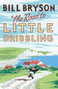
Years ago I read Bryson’s Notes From a Small Island about his trip around Britain in 1995, and since then I’ve also read A Walk in the Woods about his hike along the Appalachian Trail, the longest continuous footpath in the world, both of which fascinated me. So I was keen to read The Road to Little Dribbling:More Notes from a Small Island, which was first published in 2015, 20 years after his first trip.

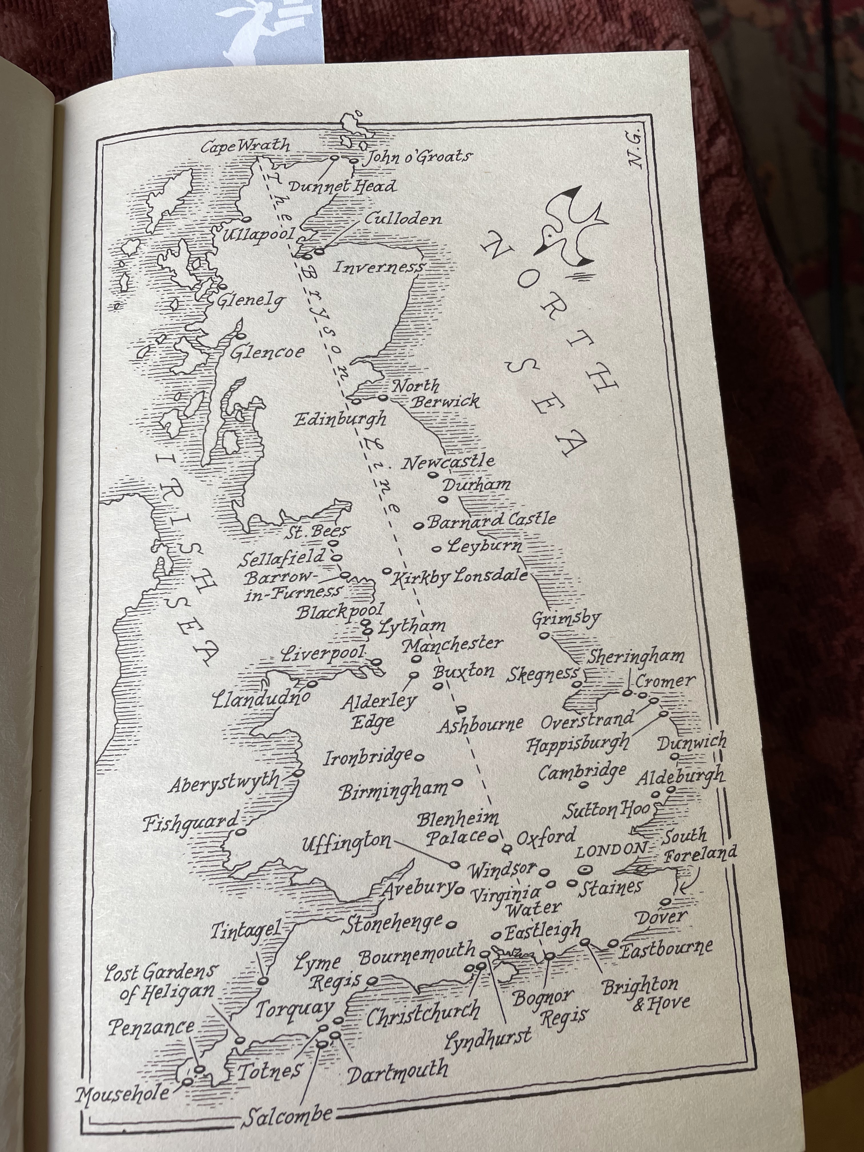
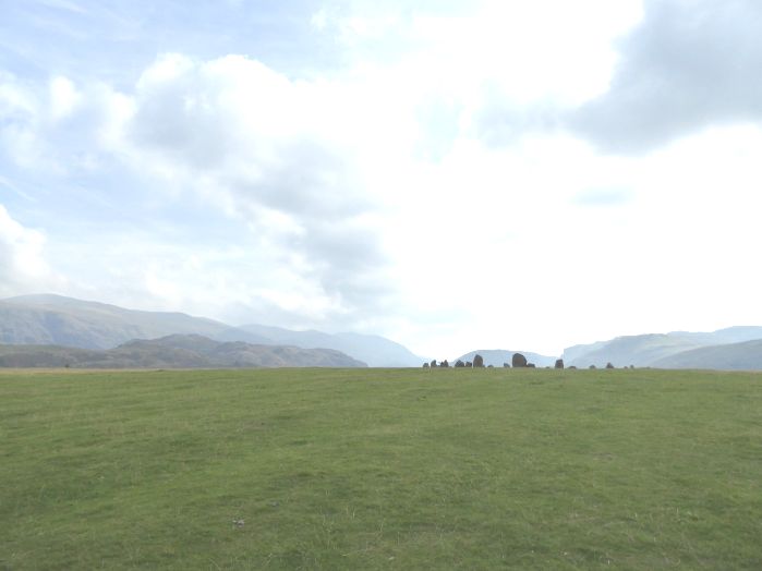
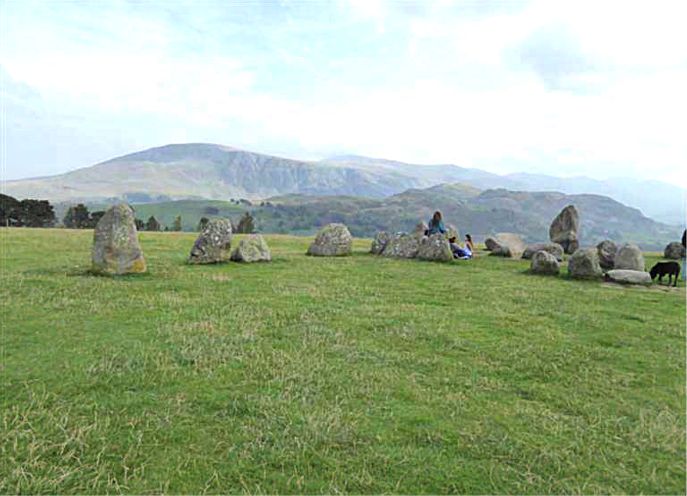
He decided to start at Bognor Regis in West Sussex on the south coast of England. He decided to try to follow the longest distance you can travel in a straight line, roughly from Bognor Regis to Cape Wrath. But he realised it wouldn’t be practical to follow it precisely, so he just started and ended at its terminal points and then meandered from place to place as his fancy took him. Click on the photo below to enlarge.

The result is he mainly visited places in the south of England, with only a few pages covering the rest of Britain. It really could have done with an index and I toyed briefly with the idea of compiling one myself. It’s an amusing book, rather than laugh out loud funny, but I got tired of his grumpiness and of his descriptions of places that were run-down and depressing and not as he remembered them – cafes that had closed, and town centres that were empty where once they had been busy and thriving. Of course any travel book is a snapshot in time, in this book that is 2015, and over time everywhere changes for better or worse.

Bryson writes in a chatty style and goes off at various tangents, talking about the history of places and telling anecdotes, which I found very interesting. Whilst he was disappointed by some towns and cities he didn’t hold back on praising the landscape – beautiful countryside, and coastal locations. I don’t think it lives up to Notes from a Small Island but it certainly gives an insight into the best and worst about Britain in 2015.

And I never found out why it’s called The Road to Little Dribbling! Any ideas, anyone?

Book Beginnings & The Friday 56: Another Journey through Britain by Mark Probert

Every Friday Book Beginnings on Friday is hosted by Gillion at Rose City Reader where you can share the first sentence (or so) of the book you are reading. You can also share from a book you want to highlight just because it caught your fancy.

This week I’m featuring the latest book I’ve just started reading, Another Journey Through Britain by Mark Probert, which was free on Amazon UK, although it’s currently on offer for 99p.

In this book Mark Probert follows the route taken by John Hillaby in his 1960s book Journey through Britain, telling the story of his 1,100 mile walk from Land’s End in south-west England to the north-east coast of Scotland at John o’Groats. It had captured Probert’s imagination and when he entered semi-retirement in 2018 he decided to repeat Hillaby’s book, looking out for the things he wrote about in his original book and comparing how today’s Britain differed from that of fifty years earlier. He didn’t walk, though but he did it on a motor bike, a Royal Enfield Classic 500.

The Book Begins:

The visitor car park at Land’s End was almost empty and ghostly silent. It was just after 10 am on a chilly May morning.

Also every Friday there is The Friday 56, hosted by Freda at Freda’s Voice. *Grab a book, any book. *Turn to Page 56 or 56% on your  ereader . If you have to improvise, that is okay. *Find a snippet, short and sweet, but no spoilers!

These are the rules:

  1. Grab a book, any book.
  2. Turn to page 56, or 56% on your eReader. If you have to improvise, that is okay.
  3. Find any sentence (or a few, just don’t spoil it) that grabs you.
  4. Post it.
  5. Add the URL to your post in the link on Freda’s most recent Friday 56 post.

Pages 55-56:

Beside the National Parks there are thirty four Areas of Outstanding National Parks (AONB) in England and Wales, less than half of which were in existence in 1966. Being British, we have to make things complicated. In Scotland they have two National Parks, forty five National Nature Reserves, three UNESCO GeoParks and two UNESCO Biospheres. The original purpose of the Parks was to conserve and preserve, but also to open the areas up for people to enjoy. Nowadays, the National Parks cover approximately 10 percent of England, 20 percent of Wales and 7 percent of Scotland.

Long Road from Jarrow: A journey through Britain then and now by Stuart Maconie

I knew of the Jarrow March/Crusade in 1936, but not much about it beyond the fact that men from Jarrow in Tyneside marched from their home town to London to present a petition against the mass unemployment and extreme poverty in the north-east of England. Stuart Maconie has filled in the gaps in his excellent book Long Road from Jarrow: A journey through Britain then and now. In October last year he retraced the route they took, 300 miles, comparing what conditions and attitudes were like in 1936 with those of 2016. The men were accompanied for part of their march by Ellen Wilkinson, who was the MP for Middlesbrough East and it was Ellen who presented their petition to the House of Commons. But despite their protest and all Ellen Wilkinson’s efforts on their behalf it didn’t result in any improvements for employment in Jarrow.

Maconie a writer, broadcaster and journalist, writes fluently and with conviction. The Long Road from Jarrow is a mix of travel writing, social and cultural history and political commentary, with the main emphasis on the current social, cultural and political scene. It’s a thought-provoking book that both entertained and enlightened me. Maconie writes about the past, the history of the places he walked through and the tales and reminiscences of the people he met. He also writes with enthusiasm on such topics as football and music and food. It’s a lively, chatty account that includes the thorny topic of Brexit, the current and past state of the north/south divide and considers what it is to be ‘British’.

I was fascinated and thoroughly enjoyed this walk through England, past and present. My copy is an ARC from the publishers via Netgalley.

  • Format: Kindle Edition
  • File Size: 1617 KB
  • Print Length: 365 pages
  • Page Numbers Source ISBN: 1785036319
  • Publisher: Ebury Digital (20 July 2017)

Castlerigg Stone Circle

Stone circles are amongst the most tangible and durable connections to the past. They have fascinated me ever since I was a young teenager and saw Stonehenge. We were on our way to Girl Guide camp in the New Forest, travelling overnight by coach from Cheshire and reached Stonehenge just before dawn. I was just about awake as we scrambled down from the coach and made our way over the field to be at Stonehenge as the sun came up. It was magical.

We were the only people there and in those days Stonehenge was fully accessible. I’ve been there since, and seen it on TV but I am so glad I had that experience before full access to Stonehenge was available, before there was a carpark and a visitor centre, shop and cafe. Now you can only view the stones from a short distance away along a tarmac pathway – after you’ve planned your visit in advance, parked your car and been driven 10 minutes by a shuttle bus, because entry to Stonehenge is by timed tickets. (Access is free at the solstices.)  I understand the need for all this but it still makes me shudder.

When I discovered that there is a stone circle near Keswick I was keen to go there whilst we were staying in the Lake District last week. Although there were more people at Castlerigg Stone Circle than I would have liked I really did appreciate the informality of the site.  There are no restrictions and you can wander around the stones as much you like. I suppose you’d have to get there at dawn or at least a lot earlier than we did to be there on your own.

Castlerigg is set on a plateau near Keswick, surrounded by hills, including Skiddaw and Blencathra. There is no carpark, visitor centre or shop – and I hope it stays that way. You can park in a little lane, where there was an ice-cream van selling delicious home-made ice-cream on the day we were there.

This was our first sight of the stones:

Approaching Castlerigg Stone Circle (1)  P1010056

Stone circles are ancient monuments. There are over 50 stone circles in the Lake District, made with locally available stones. Nobody knows what their function was, although there is much debate about whether they had a ritual and religious use, an astronomical significance or an economic function.

Castlerigg dates from around 5,200 BC which makes it older than the pyramids! Here is part of the circle. It is about 30 metres in diameter, which makes it quite difficult to take photos of the whole circle:

Castlerigg view 2

As you can see that the stones vary in size. The tallest stone is 2.3 metres and the largest weighs about 16 tonnes.

Castlerigg P1010061

And here are two photos of parts of the interpretation boards:

Int Bd Castlerigg P1010051

Int Bd Castlerigg P1010052

Castlerigg Stone Circle is described A Guide to the Stone Circles of the Lake District by David Watson, published in 2009 with colour photographs, maps and directions to the sites. The cover photo shows Castlerigg Stone Circle.

For more Saturday Snapshots see Melinda’s blog West Metro Mommy Reads.

Saturday Snapshot

We’ve been away last week – we went here:

Caringorms P1080750
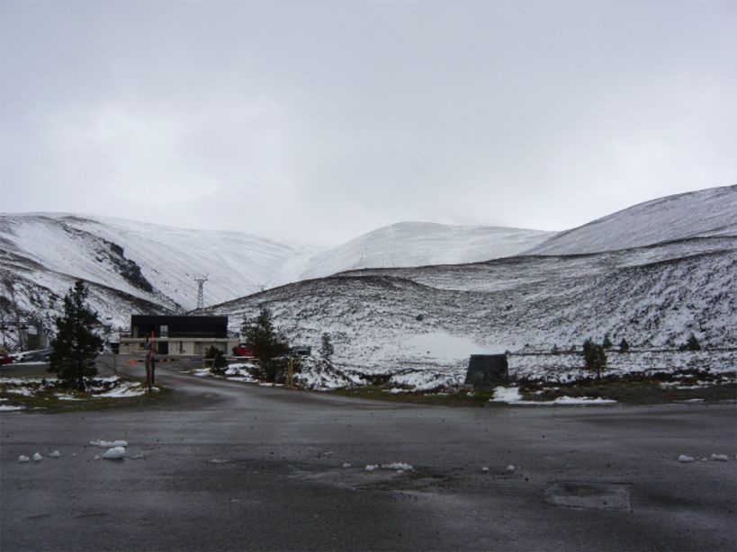
the Cairngorms – and there was snow in May.

Cairngorm shop P1080752
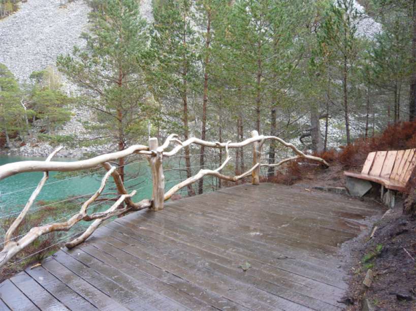
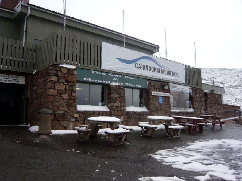
Lower down the snow fell too but didn’t stick. The photo below is of a beautiful little loch in the Glenmore Forest Park, An Lochan Uaine the ‘green lochan’ (although in my photo it looks blue – it was really green!). ‘Lochan’ is Gaelic for ‘ a small loch, or lake’.

An Lochan Uaine P1080677
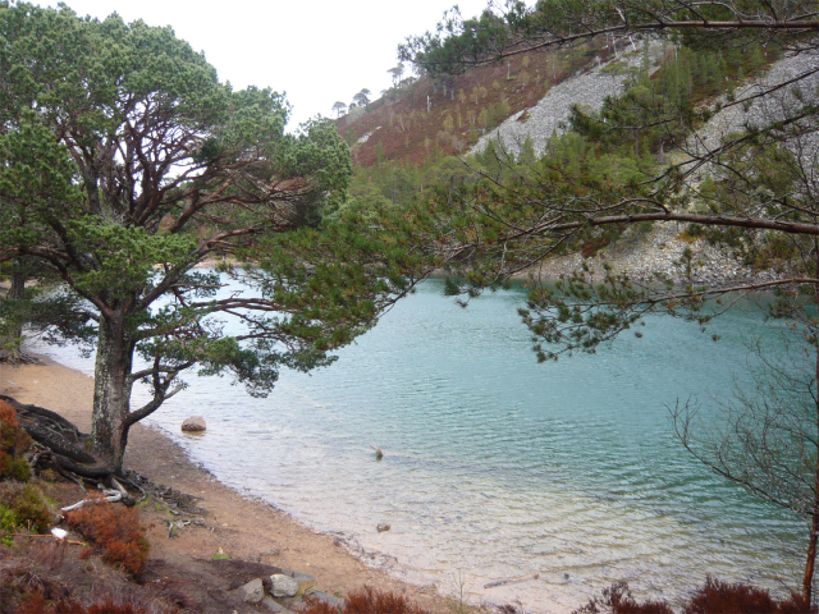
The green shows up more in this photo:

An Lochan Uaine P1080681

We have many more photos, which no doubt, I’ll be posting and writing about later. Click on the photos to see them enlarged.

For more Saturday Snapshots see Melinda’s blog West Metro Mommy.

Berwick's Elizabethan Ramparts

Following on from last Saturday’s Saturday Snapshots here are a few more photos of Berwick-upon-Tweed, which is the northernmost town in England. It’s a Border town that changed hands between England and Scotland 14 times until it finally became part of England in 1482. It’s a walled town; the original medieval walls were built in the 13th century and the Elizabethan Ramparts, dating from 1558 are virtually intact.

Berwick Elizabethan Ramparts

The fortifications replaced the medieval wall on the North and East sides of the town. The photo above shows part of the Elizabethan wall that is now the boundary wall of a car park.

Below are two photos of sections of the walls:

Berwick Ramparts 1

Berwick walls & bridges

The photo below shows a Russian cannon, captured in the Crimea. Before the Second World War this part of part of the walls was once bristling with artillery. All that remains now is this cannon which was brought back as one of the trophies at the end of the Crimean War (1854-56). The top of the barrel of the gun is embossed with the double-headed eagle emblem of the Russian Tzar.

Berwick Ramparts Canon

For more Saturday Snapshots see Alyce’s blog At Home With Books.